|
|
|
|
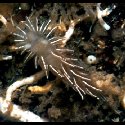
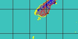
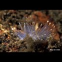
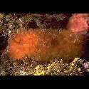
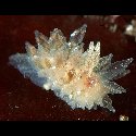
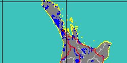
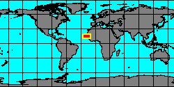
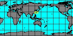
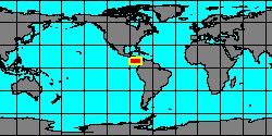
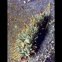
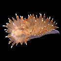
5540000003
Caldukia
affinis
(R.F. Burn, 1958)
Bundeena, Port Hacking,
New South Wales
20 mm
|
|
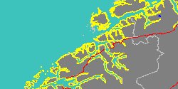
No Georeferenced data available
|
|
|
|
|
|
|
|
|
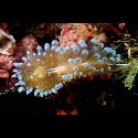
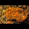
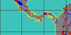
3300150035
Janolus
anulatus
Y. Camacho-García
& T.M. Gosliner, 2006
Punta Arenas, Costa Rica
|
|
|
|
|
|
|
|
|
|
|
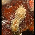
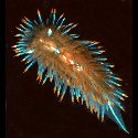
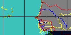
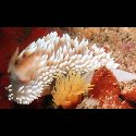
3300000000
Janolus
barbarensis
(J.G. Cooper, 1863)
Farnsworth Banks,
Southern California
50 mm
|
|
No Georeferenced data available
|
|
|
|
|
|
|
|
|
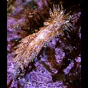
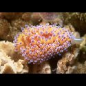
5540000008
Janolus
capensis
L.S.R. Bergh, 1907
Brazen Head, Transkei,
South Africa
60 mm
|
|
No Georeferenced data available
|
|
|
|
|
|

|
|
3300150038
Janolus
chilensis
M.A. Fischer, J.L. Cervera
& J.A. Ortea, 1997
|
|
No Georeferenced data available
|
|
|
|
|
|
|
|
|
|
|
3300000030
Janolus
eximius
M.C. Miller
& R.C. Willan, 1986
New Zealand, Three Kings Islands
19 mm
|
|
|
|
|
|
|
|
|
|
3300150024
Janolus
faustoi
J.A. Ortea & E.M. Llera,
1988
|
|
No Georeferenced data available
|
|
|
|
|
|
|
|
|
|
|
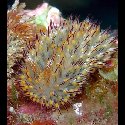
3300000035
Janolus
ignis
M.C. Miller
& R.C. Willan, 1986
New Zealand, Poor Knights Islands
30 mm
|
|

|
|

|
|
|
|
|
|
3300150016
Janolus
indicus
(C.N.E. Eliot, 1909)
|
|
No Georeferenced data available
|
|
|
|
|
|
|
|
|
5836000002
Janolus
kinoi
Edmunds & Carmona, 2017
|
|
No Georeferenced data available
|
|
|
|
|
|
|
|
|
|
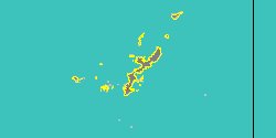
3300150012
Janolus
mokohinau
M.C. Miller
& R.C. Willan, 1986
New Zealand, Poor Knights Islands
|
|
|
|
|
|
|
|
|
|
3300000025
Janolus
mucloc
(Er. Marcus, 1958)
|
|
No Georeferenced data available
|
|
|
|
|
|
|
|
|
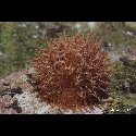
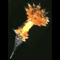
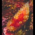
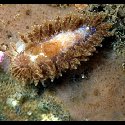
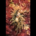
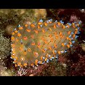
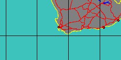
5540000006
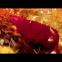
Bonisa
nakaza
T.M. Gosliner, 1981
South Africa, False Bay
90 mm
|
|
|
|
|
|
|
|
|
|
|
|
3300150008
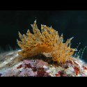
Janolus
rebeccae
M. Schrödl, 1996
northern Chile
43 mm
|
|
No Georeferenced data available
|
|
|
|
|
|
|
|
|
5540000009
Janolus
savinkini
A.V. Martynov
& T.A. Korshunova, 2012
|
|
No Georeferenced data available
|
|
|
|
|