WMSD - Worldwide mollusc species DB Bagni Liggia

Class: GASTROPODA
--- Taxon Tree: CAENOGASTROPODA [Subclass] - NEOGASTROPODA [Order] - CONOIDEA [Superfamily]
------ Family: MANGELIIDAE Fischer, 1883 (Sea)
DB counters: Genus=69, Subgenus=1, Species=1101, Subspecies=90 ( 506 Species and 25 Subspecies have images)
DB counters include Fossil taxa: Species=202, Subspecies=5

« Previous 1 2 3 4 5 6 7 8 9 10 11 12  13 14 15 16 17 18 19 20 21 22 23 24 25 26 27 28 29 30 31 32 33 Next »

2128810765

Neoguraleus
finlayi

A.W.B. Powell, 1942

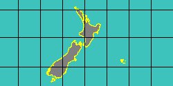
New Zealand
11,8 mm

Map center:  S: 40° 30' 21'' E: 167° 58' 56''  - Grid: 5° - click to open

2128809385

Mangelia
finterae

G.B. III Sowerby, 1894


No Georeferenced data available

2122300120

Curtitoma
fiora

(W.H. Dall, 1919)

Arctic

No Georeferenced data available

6510000052

Bela
fiorentina

G. Della Bella, Naldi
& Scarponi, 2015


No Georeferenced data available

2123500025

Guraleus
flaccidus

(G.B. Pritchard
& J.H. Gatliff, 1899)


South Australia

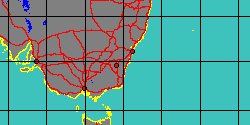
Map center:  S: 36° 36' 28'' E: 139° 44' 9''  - Grid: 5° - click to open

2128806665

Guraleus
flavescens

(G.F. Angas, 1877)

Australia, Sydney

Map center:  S: 33° 51' 53'' E: 151° 10' 31''  - Grid: 5° - click to open

6510000031

Fusiguraleus
flexicostatus

(FOSSIL)
(A.W.B. Powell, 1942 †)

New Zealand

Map center:  S: 40° 30' 21'' E: 167° 58' 56''  - Grid: 5° - click to open

2128806675

Guraleus
florus

B.C. Cotton, 1947

Australia

Map center:  S: 25° 44' 30'' E: 136° 5' 46''  - Grid: 5° - click to open

5364000723

Mangelia
forcellii

L. Bozzetti, 2014

Madagascar, Lavanono

Map center:  S: 25° 10' 35'' E: 44° 33' 1''  - Grid: 5° - click to open

2128809395

Mangelia
fordii

E.A. Smith, 1888


No Georeferenced data available

2128801505

Bela
fortis

(L.A. Reeve, 1844)

Mediterranean Sea

Map center:  N: 37° 30' 12'' E: 17° 2' 29''  - Grid: 5° - click to open

2128813585

Pseudorhaphitoma
fortistriata

(E.A. Smith, 1888)

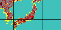
Japan

Map center:  N: 36° 43' 16'' E: 138° 49' 13''  - Grid: 5° - click to open

2123500030

Guraleus
fossa

C.F. Laseron, 1954

New South Wales

Map center:  S: 34° 47' 11'' E: 150° 11' 4''  - Grid: 5° - click to open

2128814865

Tenaturris
fulgens

(E.A. Smith, 1888)

Brazil, Sao Paulo
6,8 mm

Map center:  S: 24° 6' 48'' W: 45° 44' 2''  - Grid: 5° - click to open

2128801515

Mangelia
fulvicans

(H. Strebel, 1908)

Antarctica

No Georeferenced data available

2128805255

Eucithara
funebris

(L.A. Reeve, 1846)

Japan

Map center:  N: 36° 43' 16'' E: 138° 49' 13''  - Grid: 5° - click to open

2140013192

Ithycythara
funicostata

E. Robba, S.I. Di Geronimo
& al., 2007


Thailand, Ban Laem
5,2 mm

Map center:  N: 13° 8' 8'' E: 100° 3' 49''  - Grid: 5° - click to open

2123200035

Eucithara
funiculata

(L.A. Reeve, 1846)

Philippines, Olango Island
12 mm

Map center:  N: 10° 15' 52'' E: 124° 3' 23''  - Grid: 5° - click to open

2122750015

Bela
fuscata

(G.P. Deshayes, 1835)

Italy, Grado
7,1 mm

Map center:  N: 45° 26' 46'' E: 12° 25' 40''  - Grid: 5° - click to open

2128813595

Pseudorhaphitoma
fuscescens

(K.H.J. Thiele, 1925)

Myanmar

Map center:  N: 16° 47' 23'' E: 95° 50' 30''  - Grid: 5° - click to open

2125350050

Pyrgocythara
fuscoligata

(P.P. Carpenter, 1856)

Panama West
6 mm

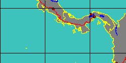
Map center:  N: 7° 23' 41'' W: 82° 59' 20''  - Grid: 5° - click to open

2128800265

Agathotoma
fusconotata

(P.P. Carpenter, 1864)


No Georeferenced data available

2128818895

Antiguraleus
fusiformis

R.K. Dell, 1956

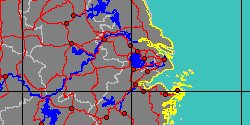
China, Zhejiang
38,1 mm

Map center:  N: 31° 6' 0'' E: 119° 42' 0''  - Grid: 5° - click to open

2126550000

Eucithara
fusiformis

(L.A. Reeve, 1846)

Philippines, Olango Island
16,2 mm

Map center:  N: 10° 15' 52'' E: 124° 3' 23''  - Grid: 5° - click to open

2128802175

Brachycythara
galae

(FOSSIL)
W.G. Fargo, 1953 †

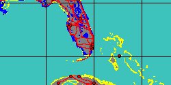
Florida

Map center:  N: 26° 15' 23'' W: 80° 52' 42''  - Grid: 5° - click to open

6476000042

Brachycythara
galae
dimonia

(FOSSIL)
A.A. Olsson
& A. Harbison, 1953 †


Florida
9 mm

Map center:  N: 26° 15' 23'' W: 80° 52' 42''  - Grid: 5° - click to open

2128800565

Antiguraleus
galatea

R.N. Kilburn, 1994


No Georeferenced data available

2128802435

Citharomangelia
galigensis

(J.C. Melvill, 1899)


No Georeferenced data available

6476000040

Mangelia
gardnerae

(FOSSIL)
W.C. Mansfield, 1930 †

Florida, Leon County

Map center:  N: 30° 29' 26'' W: 84° 11' 8''  - Grid: 5° - click to open

2128808655

Mangelia
gazellae

(H. Strebel, 1905)

Argentina
10,8 mm

Map center:  S: 36° 3' 44'' W: 64° 23' 13''  - Grid: 5° - click to open

2140013214

Tenaturris
gemma

(E.A. Smith, 1884)

Brazil, Guarapari
6,8 mm

Map center:  S: 21° 41' 57'' W: 41° 13' 28''  - Grid: 5° - click to open

2128809405

Mangelia
gemmula

W.H. Turton, 1932


No Georeferenced data available

2122200005

Genotina
genotae

J.L. Vera-Peláez, 2004

Philippines, Aliguay Island
25,3 mm

Map center:  N: 8° 41' 32'' E: 123° 25' 25''  - Grid: 5° - click to open

2115508240

Belalora
gentatuana

(S. Nomura & H. Niino,
1940)


No Georeferenced data available

8038001358

Curtitoma
georg?ssiani

Merkuljev, 2017


No Georeferenced data available


« Previous 1 2 3 4 5 6 7 8 9 10 11 12  13 14 15 16 17 18 19 20 21 22 23 24 25 26 27 28 29 30 31 32 33 Next »

Author: Claudio Galli - last updated: 25/nov/2017